
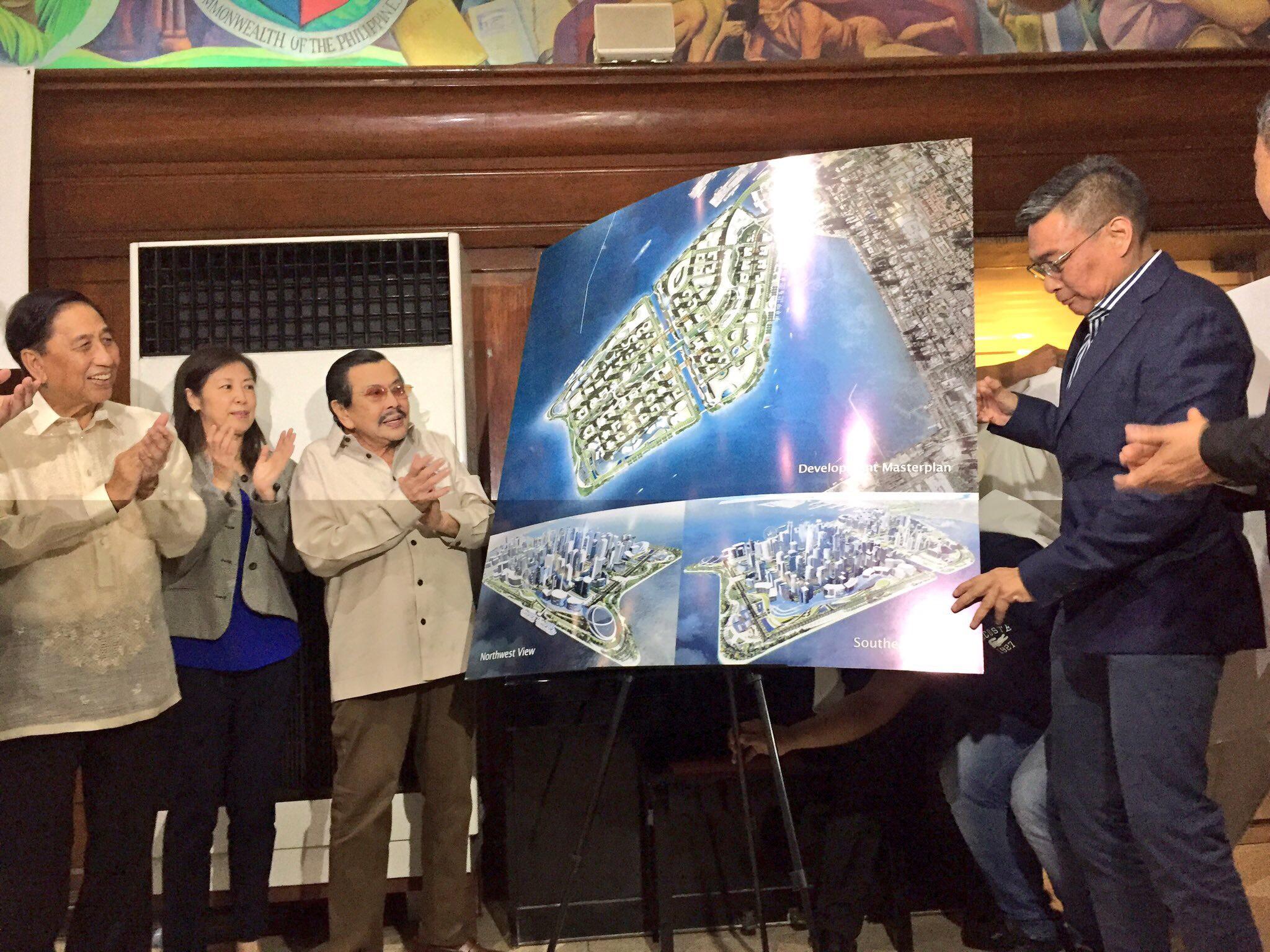
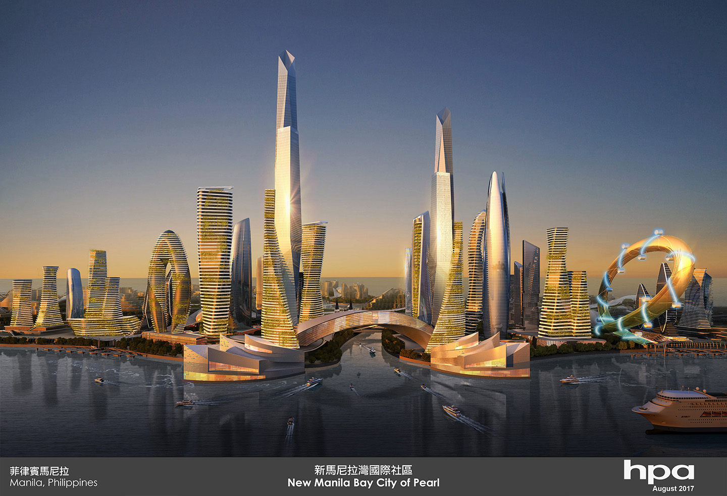
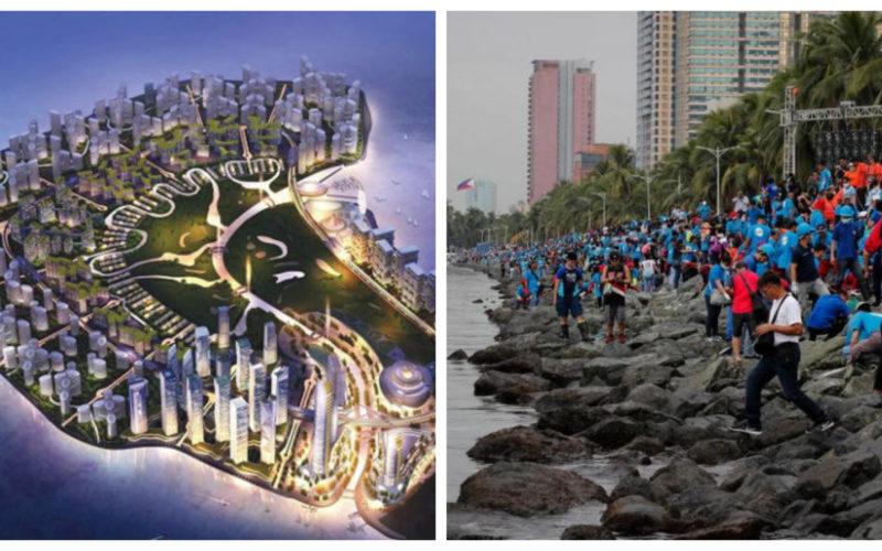
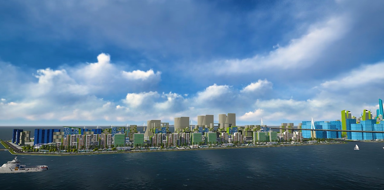
The Manila Waterfront Reclamation Project is going to be the world’s largest smart city.


Find out how your company can win this multi-billion dollar project that will be completed within 5 years.
This is a 6 part article series.
| Project Title | MANILA WATERFRONT CITY RECLAMATION PROJECT |
| Project Location | City of Manila |
| Nature of the Project | Reclamation Project |
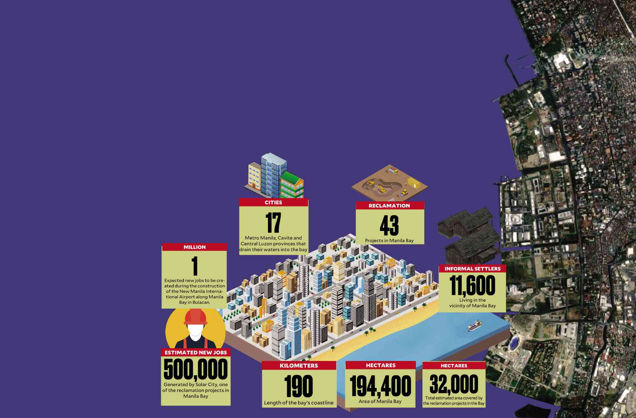
| Total Area Covered | 318 hectares |
| Project Duration | Five (5) years |
| Estimated Manpower: | 600 |
| Project Cost: | Php 34.377 Billion |
| Project Proponent | City Government of Manila Proponent Address Manila City Hall Bldg. A. J. Villegas St. Ermita, Manila |
| Contact Person: | Only GineersNow advertisers can view this info.
Contact Ms. Ems at +63 921 7105796 to view the entire document |
| Designation: | Only GineersNow advertisers can view this info.
Contact Ms. Ems at +63 921 7105796 to view the entire document |
| Contact Details: | Only GineersNow advertisers can view this info.
Contact Ms. Ems at +63 921 7105796 to view the entire document |
| Project Manager: | Only GineersNow advertisers can view this info.
Contact Ms. Ems at +63 921 7105796 to view the entire document |
| Bidding Committee: | Only GineersNow advertisers can view this info.
Contact Ms. Ems at +63 921 7105796 to view the entire document |
| Chief Engineering Team: | Only GineersNow advertisers can view this info.
Contact Ms. Ems at +63 921 7105796 to view the entire document |
| Construction Director: | Only GineersNow advertisers can view this info.
Contact Ms. Ems at +63 921 7105796 to view the entire document |
| Water Director: | Only GineersNow advertisers can view this info.
Contact Ms. Ems at +63 921 7105796 to view the entire document |
| Land Director: | Only GineersNow advertisers can view this info.
Contact Ms. Ems at +63 921 7105796 to view the entire document |
| Procurement Director: | Only GineersNow advertisers can view this info.
Contact Ms. Ems at +63 921 7105796 to view the entire document |
Project Components
The major components of this project covered by the request for Environmental Compliance Certificate (ECC) are the following: Land mass (development/construction), Infrastructures (construction), Utilities (materials and installation) and road network.

To develop the two island mass for the proposed Manila Waterfront City the following components / activities will be done:
- Dredging operation involves the removal of unsuitable materials within the project area and in the borrow materials source. The operation also involve in the extraction of suitable marine borrow materials from the source to be utilized in the reclamation area.
- Filling operation involves in the disposal of unsuitable materials and depositing to a nearby disposal area and the filling of suitable marine borrow material to the reclamation area.
- Continuous extraction, transport, and placement activities on the project area until a desired construction level is obtained to allow for installation of steel sheet piles and continuous filling up of the enclosed area until a final elevation is achieved
- Wall containment structures consist of sheet piles installed around the perimeter of the proposed reclaimed area. The general procedure in the installation of sheet pile is the choice of a suitable driving system which is of fundamental importance to ensure successful pile driving operation with due regards to safety
- Soil stabilization current technique widely adopted in reclaimed areas is the surcharge loading with vertical drains method. The tolerable settlement required or no settlement at all.
The infrastructures to be built are the two access bridges as overhead link connecting to the inland through South Drive road and Padre Burgos Avenue. The two other bridges are the one that will connect the two land mass island, including all the man outdoor mall bridges for pedestrians.

Utilities to be installed are the following:
- Drainage system consist of networks of drainage pipelines (reinforced concrete pipe) and/or covered canals, box culvert, manholes, inlets and other appurtenant structures.
- The water supply system must be designed for such a manner that water supply is assured even during times of low pressure and to the total water demand. The proposed system shall be connected to the Manila Water Service Inc. distribution system
- The sewerage system will have its own integrated sewage disposal system with a sewage treatment plant (STP)
- Power Supply requirement of the reclamation area shall be supplied by Manila Electric Company (MERALCO) from their nearest existing 115 KV transmission lines coming from primary MERALCO transformer sub-station.
- Telecommunication service in the project area shall be the extended lines from the nearest existing Philippine Long Distance Company (PLDT) telephone exchange or other telecommunication provider. The overhead telephone cables will follow the electric power distribution lines as is possible or will have a telecommunication line in the underground duct banks.
Road network will basically service vehicular traffic that will be generated by the proposed developments within the area. The road network includes the main roads, interior secondary roads, Causeways, coastal roads sidewalks and curb & gutters.
Process Documentation of the Conduct of EIA
The Manila Waterfront City Reclamation Project falls under Category A: Environmental Critical Project (ECP) per EMB Memorandum Circular 2014-005. The content of the EIS is based on the checklist as a result of the conduct of Technical Scoping held last January 25, 2018 per EMB-DENR Revised Procedural Manual (RPM).
Documentation for this project is the Environmental Impact Statement since it deals only with the creation of new reclaimed land. It does not fall under the programmatic type or Programmatic Environmental Impact Statement (PEISS) since no definite detailed activities/plans of the locators for the reclaimed land are available. Locators will apply for individual ECC during the Operations Phase.
The details of the reclamation project are established post ECC as stipulated in Revised Procedural Manual as quoted:
iii) During the project’s Detailed Engineering Design (DED) stage, which is post-ECC, the generic measures identified during the EIA study at the Feasibility Study (FS) stage will now be detailed based on the project facility design and operational specifications. Additional baseline monitoring may also be required prior to construction or implementation of the project to provide a more substantive basis for defining the environmental management and monitoring plans.
EIA Preparer Engineers and Contact Person |
Module |
Registration No. |
| Only GineersNow advertisers can view this info.
Contact Ms. Ems at +63 921 7105796 to view the entire document |
Team Leader / Air | IPCO – |
| Only GineersNow advertisers can view this info.
Contact Ms. Ems at +63 921 7105796 to view the entire document |
Project Coordinator/Terrestrial Ecology | IPCO – |
| Only GineersNow advertisers can view this info.
Contact Ms. Ems at +63 921 7105796 to view the entire document |
Marine Ecology | IPCO – 038 |
| Only GineersNow advertisers can view this info.
Contact Ms. Ems at +63 921 7105796 to view the entire document |
Geology | |
| Only GineersNow advertisers can view this info.
Contact Ms. Ems at +63 921 7105796 to view the entire document |
Sociology | |
| Only GineersNow advertisers can view this info.
Contact Ms. Ems at +63 921 7105796 to view the entire document |
Fisheries/Water Quality | IPCO – 172 |
| Only GineersNow advertisers can view this info.
Contact Ms. Ems at +63 921 7105796 to view the entire document |
Coastal Resource Management | |
| Only GineersNow advertisers can view this info.
Contact Ms. Ems at +63 921 7105796 to view the entire document |
Diver Surveyor | |
| Only GineersNow advertisers can view this info.
Contact Ms. Ems at +63 921 7105796 to view the entire document |
Marine Biologist | |
| Only GineersNow advertisers can view this info.
Contact Ms. Ems at +63 921 7105796 to view the entire document |
GIS Expert | |
| Only GineersNow advertisers can view this info.
Contact Ms. Ems at +63 921 7105796 to view the entire document |
CAD expert | |
| Only GineersNow advertisers can view this info.
Contact Ms. Ems at +63 921 7105796 to view the entire document |
Technical Assistant/Collator | |
| Only GineersNow advertisers can view this info.
Contact Ms. Ems at +63 921 7105796 to view the entire document |
Oceanography, Geotechnical Analysis | |
| Only GineersNow advertisers can view this info.
Contact Ms. Ems at +63 921 7105796 to view the entire document |
Bathymetry Survey | |
| Only GineersNow advertisers can view this info.
Contact Ms. Ems at +63 921 7105796 to view the entire document |
Geotechnical Exploration |
EIA Study Schedule and Area
The EIA team undertook the following schedule from August to March 2018 as part of the preparation and conduct of the EIA process:
Conduct of survey, field investigation and site inspection of the project including the outlying areas to determine its biophysical conditions (i.e., air and water quality, noise/sonic environment, land such as geological, etc.)
Conduct site and technical scoping to determine the issues to be addressed by the EIA team Conduct researches and gather data or information on the impact study area.
Conduct geological exploration, bathymetric survey, traffic study, oceanography, marine ecology, climatology and socio-economic of the project.
Review environmental regulations and standards implemented in the Philippines that cover the project.
The study area covers the 318 hectares which is situated within Manila Bay area at the back of Quirino grandstand.

EIA Methodologies
The study took into consideration the establishing of the baseline information of the area that will be affected by the reclamation project.
The mitigating measures to be implemented and integrated in the study. Both primary and secondary data were utilized on the assessment of various impacts. Primary data were obtained through on-site investigation and field sampling and surveys while secondary data were collected from the proponent and from related government agencies/institutions. Sampling methodologies employed during the EIA process are listed below.
Land Use
Gathering and review of secondary data from the City CLUP, site observation and validation. Also taking into consideration Manila Bay Coastal Strategy, the Philippine Reclamation Authority (PRA) Boulevard 2000 Plan and its implementing Rules and Regulation, the Supreme Court Mandamus on Manila Bay, classification of the Environmental Critical Areas (ECA) and the National Integrated Protected Areas System (NIPAS).

Geology and Geomorphology
Site observation and gathering/review of secondary data from related government agencies and institutions. Conduct of Bathemetric Survey and sea bed exploration by boring
Hydrology/Hydrogeology
Site observation, gathering of secondary data, analysis and interpretation using data on slope, land use, climatic normal and extremes.
Water Quality of the Manila Waterfront Reclamation Project
Analysis and evaluation of monitoring results, site observation/interviews, grab sampling and laboratory analysis.
Meteorology of the Manila Waterfront Reclamation Project
Gather and review of secondary data.

Air and Noise Quality of the Manila Waterfront Reclamation Project
Analysis and evaluation of monitoring results, gathering /review of secondary data, site observation/validation, air sampling and laboratory analysis.
Socio- cultural and Economic profile of the Manila Waterfront Reclamation Project
Review of secondary data and household interview.
Project Perception of the Manila Waterfront Reclamation Project
Key Informant interview, Focus group discussion, household interviews and review of secondary data and Traffic Management Study.

Public Participation of the Manila Waterfront Reclamation Project
Public participation in the EIA process was achieved through the conduct of different social research methodologies such as site investigation key informant interviews, focus group discussions, perception surveys and the Public Scoping. These activities, both formal and informal, have provided avenues for the stakeholders to express their issues, concerns and perception about the project.
Summary of Baseline Characterization
Baseline characterization was categorized into four (4) major modules: Land, Water, Air and People. The table below shows the summary of corresponding findings based on the study.
Land Use of the Manila Waterfront Reclamation Project
By the nature of the project, it being in water and not land base, the site which is in the Manila Bay is not covered by the existing Comprehensive Land Use Plan and Zoning Ordinance (MLUCOZO) year 2005-2020 of the City of Manila. With respect to compatibility of the site to the coastal resource management plan of the LGU (City of Manila), the fact that it is the City itself approved the unsolicited proposal and entered into a JV Agreement with the Project Implementer for the development of this project is sufficient proof of compatibility.
The proposed project site is in Manila Bay and is not included in any of the 12 ECA Categories identified in the Revised Procedural Manual of DAO 2003-30, also in the list of 240 protected areas of the Philippines as of 2012 administered by the Department of Environment and Natural Resources’ Biodiversity Management Bureau under the National Integrated Protected Areas System (NIPAS) Act of 1992.

Geology/Geomorphology of the Manila Waterfront Reclamation Project
Previous geotechnical works in the reclamation area, reveals a soft to very stiff, low to high plasticity clay with seams of sand underlies the proposed project area. The clay layers, in turn, are underlain by tuff, presumably belonging to Guadalupe Formation, which was encountered at depth of about 26 meters below sea level. Onshore, the alluvium in the Coastal Lowland covers the surface to a depth of 60 m (Allen et al., 2014), underlain by the pyroclastic deposits of the Guadalupe Formation.
The Metro Manila is divided into three distinct geomorphic regions: the Central Plateau, the Marikina Plain, and the Coastal Lowland (MMEIRS, 2004; Allen et al., 2014). The Coastal Lowland on which the project site is located consists of coastal landforms like back marshes, sandbars, beach ridges, as well as the Pasig River delta and the reclaimed land area.
The alluvial deposits reach to a thickness of around 60 m towards the Manila Bay, near the Pasig River Delta (MMEIRS, 2004; RAP, 2013). Permanent changes in sub-surface characterization morphology in the reclamation area expected as a result of the dredging and filling operations. A new landmass will be created which is the reclaimed land. The elevation of the platform will be higher than the MLWW by an estimated height of 4 meters’ the final design of which will be determined during the final stage of engineering work.
Water / Hydrology / Hydrogeology of the Manila Waterfront Reclamation Project
There are no streams, rivers and lake water bodies in the impact areas and neither are there any that may be affected by the Project. One of the major drainage systems of the City of Manila is the Pasig River that connects Laguna de Bay to Manila Bay. Pasig river mouth is 2.5 kilometers from the reclamation site it is the nearest body of water to the site.
The groundwater systems in the coastal areas of Manila Bay consist of Alluvial sediments. One of the areas in most risk of saltwater intrusion is Metro Manila. Since the late 1960s, saline water intrusion has been evident along the coastal areas of Metro Manila, stretching from Las Pinas to Malabon. The shallow water table aquifer is in direct contact with the sea in these coastal areas.
According to a joint study by MWSS and JICA in 1991, most groundwater samples from Metro Manila’s coastal areas were salinized. However, compared to the early 1980s, saline intrusion was found to have improved conditions because of the conversion of water source from groundwater to surface water upon the completion of the Manila Water Supply Project II in 1987.
Aside from excessive withdrawal of groundwater, seepage of brackish water along the Pasig River is another cause of saltwater intrusion because of seawater movement during tide.
Oceanography of the Manila Waterfront Reclamation Project
The baseline condition of the project area after the result of modelling are represented chart by the various for water circulation and sediment transport under different conditions are labeled as “Without Project Scenario).
For the sediment transport studies, mud was plugged into the Pasig River with a constant concentration for the duration of the simulation. Results showed that high concentration of mud was observed in the inner portion of the river extending gradually to the mouth.
Only the Baseco compound and Barangay 20 of the North Harbor were affected by the sediment plume suggesting that it will not affect directly the reclamation site.
Water Quality of the Manila Waterfront Reclamation Project
Water quality was determined by taking sea water samples in reclamation site in Manila Bay. This will be used as baseline for water quality. The sample was analyzed in accordance with the Standard Method for the Examination of Water and Wastewater, 21sted. Scientific data obtained that will serve as indicators of water quality as reflected in on-site, laboratory, and sedimentary analyses of the following parameter the pH @ 27°C, BOD, COD, BO, TSS, Cr6+ As, Cd, Hg, Oil & Grease, Total Coliform and Fecal Coliform.

Marine Ecology of the Manila Waterfront Reclamation Project
The broad survey covered a total area more than 3.5 square kilometer of coastal waters directly within the proposed reclamation area. A total of 20 manta tows were undertaken to locate, identify and characterize any benthic communities of corals, seagrass and algae beds, fish populations, submerged structures, and other benthic life forms such as anemones, gorgonians and sponges.
Results from the twenty (20) manta tows, validation dives with systematic snorkeling and four spot dives with echo sounding and sediment collection revealed the absence of coral reefs, reef associated benthic life forms, seagrass and algae colonies in the seabed in the proposed reclamation project site and contiguous areas.
The entire benthic environment is composed of mud and silt, mixed with gravel, shellfish carapace and an array of trash.
No significant aggregations of demersal fish species were encountered in the manta tows. The absence of demersal fish species in the broader area is an anticipated result in as much as no ecologically important benthic habitats exist in the area and there are no functional ecological relationships that can support a viable level of fish population.
The phytoplankton community diversity, abundance, and relative composition were determined in four marine water stations along the proposed reclamation site in Manila Bay.
A total of 32,633 cells/L belonging to sixteen (16) genera were identified for all four sampling stations, wherein the phytoplankton community are comprised of representative genera from three major phytoplankton taxa; namely, Bacillariophytes (diatoms) with nine genera, Dinophytes (dinoflagellates) with three genera and three species (6), and Cyanophytes (cyanobacteria, or blue-green algae) with a single representative genera.
The macrobenthic community diversity, abundance, and relative composition were determined in four marine water stations along the proposed reclamation site. T. A total of 26,739 indiv/m3 belonging to three major phyletic groups were quantified for all four sampling stations. These identified taxonomic phyla are namely, Annelida, Mollusca, and Nematoda. Among these, the highest number of individuals is attributed to Mollusca with 25,383 ind/m3, followed by Annelida with 723 ind/m3, and the relatively least record of 633 ind/m3 belonging to Nematoda. In terms of composition, Mollusca accounted for 94.43%, Annelida at 2.70%, and Nematoda at 2.37% for the whole accounted population.
Significant macro-invertebrate communities were along the submerged portion of the rocky revetment within the main project site complex.
The breakwater has evolved as habitat for shellfish, algae and some demersal species of fish. Gleaning for edible bivalves and gastropods of the species Asian green mussel, ark shell, various species of the zigzag venus (Manila Clam or Halaan), pitar venus, rasp tellin and isolated occurrence of Nucella lamellosa (Frilled dogwinkle) is being undertaken regularly.
The rocky revetment in the south breakwater have been colonized by Chlorophyta algae, notably the green sea feather Caulerpa sertularioides and the green algae Enteromorpha clathrata, attached to the rocks. Sertularioides is used for human consumption, animal feed, fertilizer and has an antibacterial property (FAO, 1998).

Pedology of the Manila Waterfront Reclamation Project
Sediment samples were taken in the surveyed stations and was brought in a laboratory and tested for the following parameters Hexavalent Chromium (Cr+6), Lead (Pb), Mercury (Hg), Arsenic (As) and Cadmium (Cd).
The geotechnical investigation was conducted which consists of four (4) boreholes with a total aggregate depth of 130.50m. All four (4) boreholes were drilled in the e sea bed within the vicinity of the property boundaries to establish the existing geotechnical conditions at the site.
Samples were taken in every different characteristic of soil taken in one borehole and tested for Grain Size Analysis per ASTM D422, Moisture Content per ASTM D2216, Liquid Limit, Plastic Limit and Plasticity Index of the soil samples.
Terrestrial Ecology of the Manila Waterfront Reclamation Project
Biodiversity involving terrestrial resources is not significant for the proposed reclamation project since all works will be undertaken at Manila Bay off shore and only the approaches of two infrastructure bridges will be implemented inland. Two (2) Talisai (Terminalia catappa) trees and two (2) coconut trees will be affected by the bridge construction in the South Drive bridge approach.
MWC will have approximately 12 hectares Central Park, 44 hectares Promenade/water edge and 5 hectares road strip corridors green spaces. MWC will implement an urban greening program, a systematic green space development and management for green spaces. Due to the massive green spaces available for development, establishment of Nurseries is necessary within or outside the reclamation and a unit in charge of greening that have the necessary skill, expertise and capabilities in order to carry out the tasks successfully.

Air / Climatology of the Manila Waterfront Reclamation Project
The climate at the City of Manila generally falls under Type I based on the Coronas Classification of Philippine Climate which means two pronounced seasons: dry from November to April and wet during the rest of the year.
PAGASA Science Garden Synoptic Station is 10 km South Southwest (SSW) to the proposed project site. On the other hand, The southwest wind (during the southwest monsoon season) from the South China Sea moves northeastward to the western coasts of the City. The wind arrives at the City of Manila as southwesterly winds. When the southwest monsoon season intensifies, the southwesterly wind is more prevalent. During the transition of the NE monsoon, the NE wind is the most prevalent wind at the City of Manila.
The 30-year climatological normal record, (1971-2000) at Science Garden Science Garden, the total annual rainfall is 2532.30 mm while the annual average number of rainy days per year is 153 days or about 42% of the year. The average monthly maximum temperature at Science Garden ranges from a high of 34.9°C in the month of May to a low of 30.4°C during the month of January. The highest and lowest mean monthly temperature is 29.5°C and 25.4°C which occurs during the months of May and January, respectively.
Air Quality of Manila Waterfront Reclamation Project
Samples were taken in four stations which will be used as baseline data and tested under Standard Methods for Ambient Air Quality. Test results for TSP, PM10, SO2, NOx were documented.
Noise
Based on the result of test conducted, three stations passed and one station is over the allowable limit prescribed under the Noise Emission Standard of PD 1584.
People
The total population of The City of Manila as of the latest 2015 National Statistics Office Census of Population was 1,780,148 making it the second most populous city in the Philippines.
The Direct Impact Area (DIA) for the project is the whole of Barangay 666, zone 72, District V, Ermita Manila with a total population of 980 and 750 numbers of households as of October 2017.
The City District of Ermita where Barangay 666 and 12 other Barangays are located is a significant center of finance, education, culture and commerce. It is also known as the civic center of Manila where the City Government Manila City Hall is housed and where the judicial department is located in the district along Taft Avenue and Padre Faura Street, the Supreme Court of the Philippines, the Court of Appeals, the National Bureau of Investigation, the Department of Justice, the Boy Scouts of the Philippines and also the large portion of the area’s of employment, business, and entertainment activities.
Out of the 200 respondents in the perception survey conducted, only nine percent (9%) are not aware of the project. Ninety Five percent (95%) of the respondents believed that the project will be beneficial to them.
The perceived positive effects that shall accompany the project are the economic and social benefits, including employment and associated economic development, additional tax for the host barangay and City Government, while the negative effects perceived by the respondents are pollution, flooding, noise generation and increase in solid waste.
In the latest Health Indices record of the City of Manila and the National Capital Region year 2012 a total of 40.248 live birth were recorded, while there are 12,699 total number of death. In the same year, there were 814 number of infant death, 356 fatal; death and 27 Maternal death. Respiratory tract infection ranked first followed by the ALERTI and Pneumonia, Bronchitis/Bronchiolitis, Acute Watery Diarrheal, Urinary Tract Infection, Hypertension, TB all forms, wounds, Parasitism and Influenza. Hypertension/Hypertensive Heart Disease has become the leading cause of mortality in 2015 at the record of 254 cases.
Pneumonia became the number two as Celibro Vascular Disease is the number three leading cause of mortality for adults
End of Part 1 of 6 article
For more information about the Manila Waterfront Reclamation Project construction and bidding details, please contact Ms. Ems at +63 921 7105796
Manila Waterfront Reclamation Project report Philippines, Manila Waterfront Reclamation Project city, Manila Waterfront Reclamation Project smart city, Manila Waterfront Reclamation Project Mayor Erap Estrada, Manila Waterfront Reclamation Project Amado Bagatsing, Manila Waterfront Reclamation Project city council, Manila Waterfront Reclamation Project by the bay