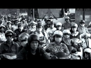

As technology advances, so does the waste products we create. We can clearly see its effects deteriorating our environment and its wildlife, and it’s really sad. What’s even worse is the pollution that spreads into the air. Car exhaust and smoke from factories emit pollutants into the air, and the effects can be felt almost immediately. While there are many organizations that are trying to clean up the air (and our entire planet in general), the only thing we can do as individuals is reduce our waste and avoid air polluted areas.


Here’s the thing though: We have no idea which places in our environment is polluted and which is not. I mean, sure, we can get a general idea, but contaminants in the air can change on an almost daily basis. And if you have any respiratory conditions like asthma, it can be pretty dangerous.
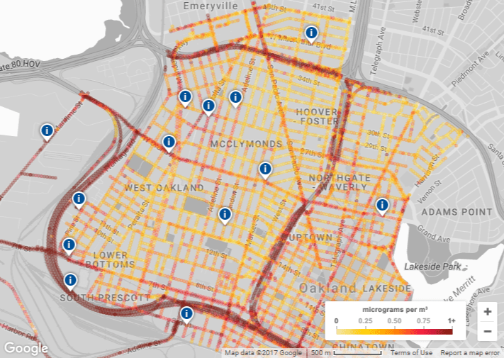
This is why Google Maps is developing their newest feature: a map that shows the air quality around you, block per block.
Source: YouTube, Environmental Defense Fund
The map is so far only available in the areas inside Oakland, California, but it’s already pretty neat. It was made in partnership with the Environmental Defense Fund (EDF) and Aclima. Aclima is a startup company that equipped and designed the sensing system to measure pollution and other environmental changes in the Bay Area, Central Valley and Los Angeles.
EDF made the map with Aclima’s data that was collected through a sensor system on Google’s StreetView cars during the entire project. Now, the map can give you data up to the street level about areas with higher amounts of nitric oxide (NO), nitrogen dioxide (NO2) and black carbon. Basically, most of the pollutants coming from car exhaust.

Source: Anith
Google is pretty proud of their work, saying that its pollution data set is the largest one to ever be published, “With nearly 3 million measurements and 14,000 miles captured in the course of a year.” Now, we’re pretty excited as to what cities they’re going to apply the technology to next, as Google is already in the process of doing so. It’s not only a useful tool for environmental scientists, but also a literal life saver for those suffering from respiratory diseases.
Article Sources: